Monday, June 29, 2009

Animals around the world

This is somewhat of a continuation of the last post. . . so fun!!

Here's what you need: A map of some sort - you can make your own out of felt like I have, make one out of paper (which I wouldn't recommend because of storage AND the usage. Why go to all the trouble if it won't last?) or just use a printed paper map. OR, (I just thought of this one), you can draw it on the driveway in chalk!!
You also need animals!! The little animals they sell in the tubes will work great or any plastic animal you have around the house. You can also find animals online, print them out and use pictures if you don't have any other resources.

I happen to personally love the Schliech brand of animals for several reasons.
1. They are extremely life-like and have minute details.
2. They are basically indestructible and have no hard plastic edges to hurt teething babies. :)
3. Amongst each other, they are sized appropriately. (the meerkat and the elephant are somewhat proportional to each other.)
4. There is a very wide selection of animals - perfect for finding animals around the world!

Where are these animals found you may be asking? Well, when Lawton was about eighteen months old, his grandparents bought him some farm animals from the local co-op. He loved them so much, family members, Santa, and occasionally we would add to the collection by going to local toy stores. They also now carry Schleich at Target in a limited selection. If all else fails, you can always get them online! They are pricier than buying the animals in big buckets or tubes, but I think they are well worth it. Animals are so open ended (for creative play, for language building, and now for some different activities that I am doing now.

Did you happen to see this activity with animals? Or what about this post as a great language building tool? Just in case you're new here . . . :)

Here's why you should do it: Again, this is a great tactile way for your kiddo to categorize animals and the world around them.

Here's how you do it: Lay out the map (however big or small)

This is what Carolina was doing most of the time . . . walking all over the maps, loving the scarf on her head and playing with her instruments. (oh, and terrorizing Lawton by picking up and moving all of his animals. ha!)
Place animals on the corresponding continents. Obviously, many animals will fit on multiple continents. Just talk through it and decide where they should go. Next time they can go on a different continent and you will never know . . . hmmmm. . . where should this camel go?
For the young child, I would just pick out one animal per continent at first. Too many can be overwhelming!
Sister finally settled down when I gave her a baggie of small animals to look at, pull out, and chew on!

North America
(which I didn't realize until later is backwards) but that's okay . . . it didn't hinder his learning!
South America
(we had to stretch on this one . . .)
Antarctica

Australia
Africa
Asia
Europe

Have fun visiting around the world!

And the winner of the small felt set from last post . . .
(I promise I use random.org, but don't know how to show that I do . . .)

#8 - Candie!
Friday, June 26, 2009

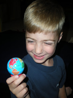
He's got the whole world in his hands!

Here's another hands-on approach to geography . . .Here's what you need: two blue felt circles and felt continent shapes (like before, North and South America - red, Africa - brown, Europe - pink, Asia - yellow, Australia - orange, Antarctica - white. You also need a reference map if at all possible and then labels if your child is old enough.
Here's why you should do it: Children learn by doing. Actually, many adults learn this way, too, but children are VERY tactile learners. This is just another reinforcement so they can learn about the continents and how our world "goes together". Just think of this as a puzzle, but a step up because there is no "control" of where each piece goes.

Here's how you do it: Place the circles (hemispheres, remember?) side by side. Look at the reference map and place the continents in the correct places. Of course, you want to be with them telling them the names of each continent, too.
Isn't that cute?? :)

Now here's the BIG DADDY map . . . I love this this. I made this for my classroom because the very few times I did a whole group time (only about ten or fifteen minutes per day) I needed/wanted a large map to lay in the floor so that all the kids could feel engaged and see what I was trying to teach them. I have a really cool post coming up using this BIG DADDY map next!
Lawton did the same thing with this map. He laid out the hemispheres and then placed the continents down.
I made some quick labels with index cards for him to label the continents and oceans. Here's another idea, though for the younger child - make cards that say Land and Water and label appropriately. Land and water are very appropriate concepts to learn on a map. If you want to break it down even simpler, fill baby food jars or those tiny disposable containers with actual land (dirt) and water tinted blue. Then you can have them place the containers on the appropriate places on the map.
And guess what? I'm giving away one small felt set! Just leave a comment . . . I'll announce the winner on Monday! (and don't forget - if your kiddo is too small now, they will be big enough to do this very soon!! :)
p.s. if you ever make/do any of these ideas, I would LOVE to see them or hear about it! That's why I'm sharing - so you can do it too and I can still "feel" like I'm teaching . . . in a roundabout way!

Tuesday, June 23, 2009

Hemisphere Shmemisphere

The next time you have some play dough out, try this activity out!

Here's what you need: some play dough, preferably blue, a knife and a rolling pin. If you're really going to get into the geography bit, I would make or find a reference map like the one I have pictured at the end.

Here's why you should do it: Maps can be a very abstract concept for little ones to understand. This just helps give a concrete representation of why a world map looks the way it does. The concept will probably still be abstract for a while . . . :)

Here's how you do it: Roll the play dough into a sphere (fancy shmancy word for a ball :)
Cut the sphere in half.
Tell them that these are the western and eastern hemispheres.
Okay, let me pause for a second. Maria Montessori termed the "Absorbent Mind", which basically means that children easily absorb anything and everything that is presented before them, more specifically from birth until the age of three. To you, "the western hemisphere" is a huge term, with a very abstract meaning, so why should you tell your toddler this?? To your three year old, "western hemisphere" is just another word they are learning everyday, like the names of all the Little Einsteins or circle, triangle and rectangle. Why not tell them all terminology and language that you can, because keeping up with all this information will be harder for YOU, not THEM.
If you are interested in learning and reading more about the absorbent mind, Montessori wrote an entire book named just that, The Absorbent Mind. Here's an interesting article about the same subject if you want a quicker read HERE.

Okay. Carrying on. . .
Roll each hemisphere out flat . . .


and then compare to a map of hemispheres. It would help if you had a globe, too. Sadly, we do not have a "real" globe yet, although Lawton would love it. The closest thing we have is a globe pencil sharpener and a kickball printed like a globe . . .
And here's a video to show you how much he really does enjoy this stuff. He gets a little excited. ha!
And the winners of the continent cards are . . .
(I used random.org but can't figure out how to show you, promise!!)
#1 - Melanie and #5 - Hayley
e-mail me with your addresses at chadandlaurabeth(at)yahoo(dot)com!
And stay tuned - more small giveaways coming up!

Friday, June 19, 2009

A geography blitz is coming! (and giveaways)

So . . . it's been a while since I've posted some "good" stuff. My apologies. I've got a geography blitz of posts lined up, so hang on! If you have a very young child and think, "this doesn't apply to me", please hang on! Your child will be old enough to do these activities before you can blink! *sniff* I will be doing a few small giveaways (or big if you don't like making things!) over the next few posts, so keep checking back! Again, if you can't use the things I'm giving away NOW, you will be able to use them soon enough!!

As some of you may know, Lawton (who turned four in April) loves maps and geography. I don't really think that he got into it because of anything I've done, just somehow it has peaked his interest and I took note. Therefore, by "following the child" which is a strong Montessori philosophy, we have helped foster his interests.

*Side note* After pondering WHY he likes maps (of the zoo, of state parks, of Disney World, of the United States, of the world, of the mall . . .) and is interested at ALL times where we are going (think holding his daddy's iphone with the moving blue dot on the map), I thought back to my childhood. I have always been fascinated with studying maps and like to know how things are connected. If I can't visualize the layout of a store in my head, it drives me crazy and I can't shop there.

I specifically remember one Saturday morning, probably when I was seven or eight, I woke up, got out the trusty encyclopedia, looked up Africa and traced it on tracing paper. Yep. For fun. Traced Africa, all the countries, rivers, cities, etc. for fun. It must have been very exhilarating because I still remember doing it in our upstairs den. Man, that's weird. Maybe the apple isn't falling far from the tree! ha!

Here's what you need: three part cards and a rug for spatial control
To make these cards, get some white card stock and then either card stock or construction paper to cut out the shapes of the continents. I guess you could just print them, but I like the tactile experience for the kids (and another idea to show you later. . . :) One card has the continent shape and the name, one card has just the continent, and the third card has just the name. (The last two cards should equal the same size as the first one. You can click on my pictures to enlarge if you don't get what I'm saying)

The continent colors are all different and correspond to the maps that I had in my classroom. Everything is color coordinated, so for example, all things associated with Africa were brown, all things associated with Asia were yellow and so on . . . (North and South America - red; Asia - yellow; Europe - pink; Africa - brown; Australia - orange; Antarctica - white)

I found these templates if you are interested in making some. I'm sure there are some better ones out there, just didn't find them. . .

Here's why you should do it: These cards will help your child get familiar with the outlines and names of the continents and just in general help with visual discrimination. I would say some older two year olds/three year olds could do this, but you know your child . . . all children are different!!

Here's how you do it: Lay out all the control cards (with the continent and name on them) while saying the name to your child. Our rug was too short . . . my Montessori trainers would have a duck if they saw that! I only bought one rug for us to have at home . . . (a towel would work great, I was just to lazy to get up and get it!)
Then match the picture of the continent to the first card.
Then, have them methodically go down and compare the continent name to the control card until a match is made. Very young children will just look at the beginning letter or the shape of the word, older children will be able to start reading the word.
For all the true Montessori people out there, I know he shouldn't be sitting on the rug, but we're at home and I'm relaxed . . . :)
All the matches are made!! You can have fun with this part and have them point to the continents you ask them for, name the continents as you point to them, have them bring cards that you ask for as you cook dinner, whatever!
And to kick off the geography blitz, I am going to give away TWO sets of these cards! I will have to make them, so give me a bit! :) Leave me a comment and I will choose two names next Tuesday. I would love to know what your kiddo is into right now, or what you were into as a kid if your baby (or loved one) is too little!

Keep checking back in! :)

Wednesday, June 10, 2009

What's going on . . .

So sorry that I have been absent . . . if you want to see what is going on in our lives, you can check on us at my main blog, high on life. Our sweet Carolina has been having some medical issues, and to be honest, I haven't been much in the mood to keep this blog up lately. Please pray that we get some good news from upcoming tests!

However, I can't not pass on a quick tidbit. Lawton got Brain Quest for a birthday present and I also had another version of Brain Quest when I taught first grade - before I went to a Montessori school. They are great, have lots of different versions for varying ages and topics, and you can use them in different ways. (They are stacks of cards with age appropriate questions and answers.)
I plan on doing it while we snuggle on the couch, maybe even as part of our dinner conversations, and especially traveling in the car!